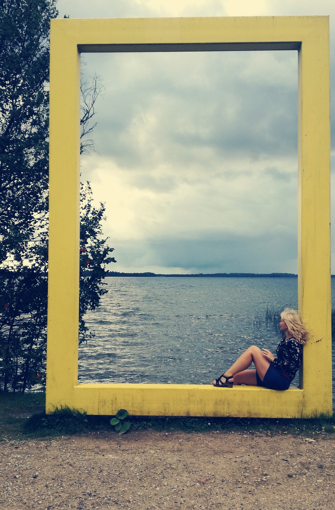
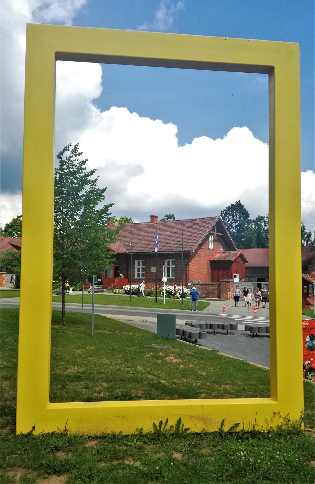
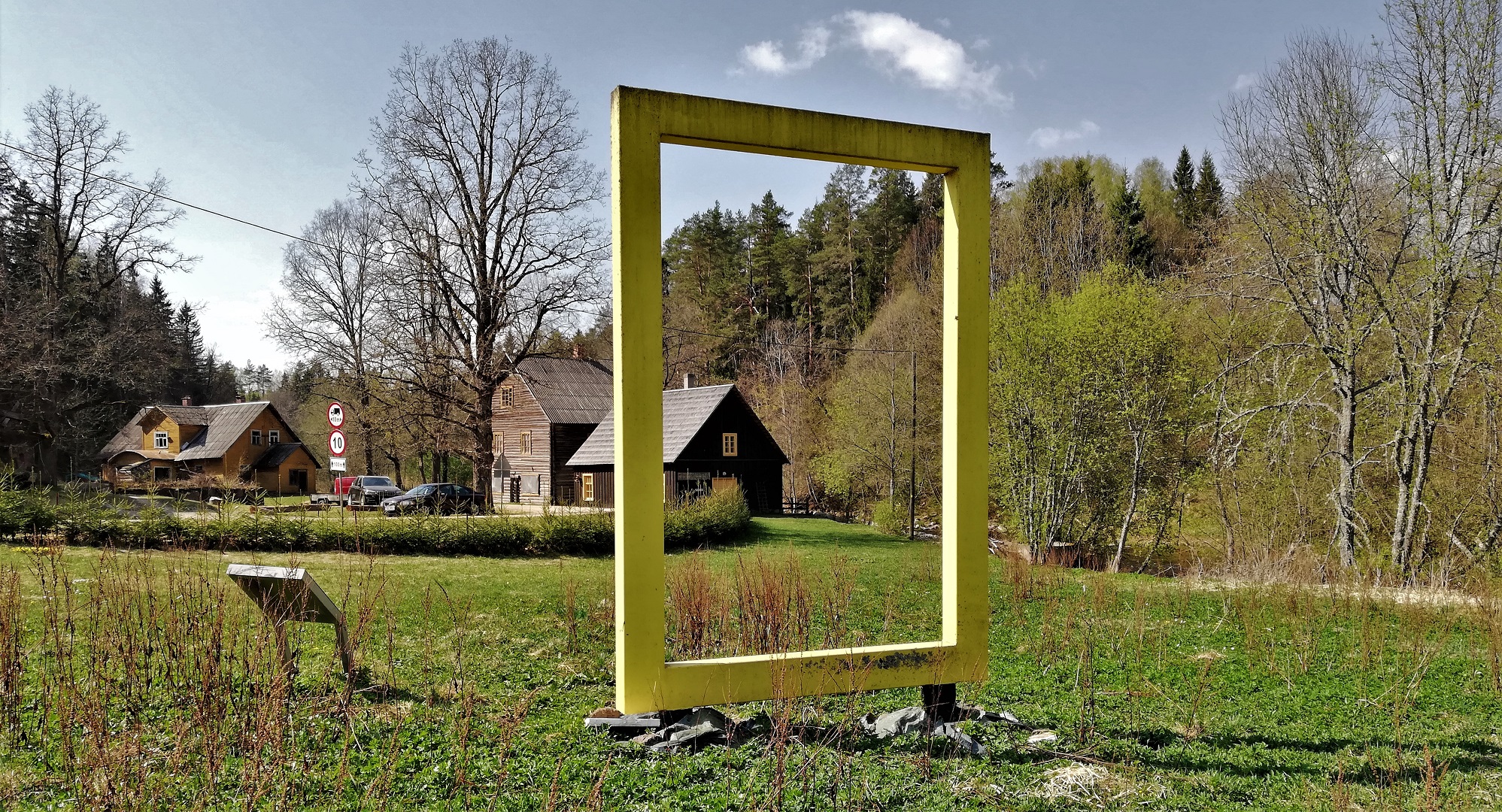
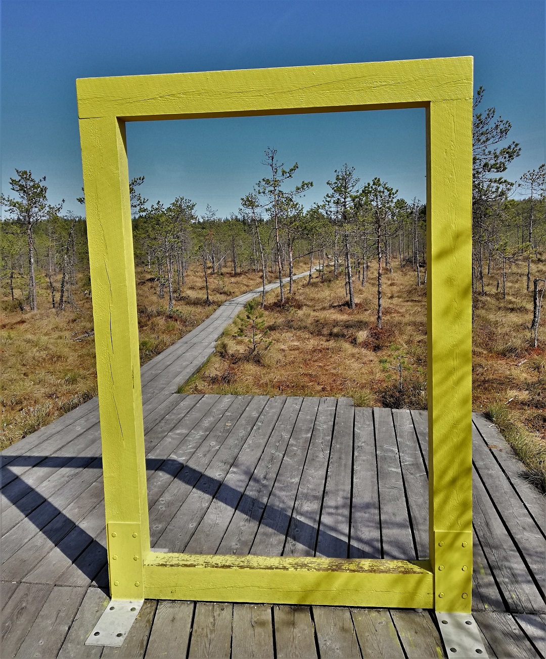
Are you looking at what to do in South Estonia or what places to put into your itinerary? Here is a great option to get started with. We have a collection of “National Geographic” inspired yellow frames in South-Estonia.
These yellow windows are strategically placed throughout South-Estonia. Each place is promoting nature, culture, or history of that place. These yellow frames encourage You to take photos through them. Most are in plain sight, but some of them are bit hidden and mysterious. I suppose it’s by design and you have to search for them. Yellow frames themselves are publicly accessible all the time and free to visit.
But be warned – it can get a bit addictive if you have more time in your hands. Some serious OCD stuff right here. We have already visited 20 of them in 3 trips in total and we are planning to complete list in 2019. At least so we thought. Please read the disclaimer below.
We hope this guide gets you inspired and sparks the idea to visit South-Estonia.
Disclaimer – locations are in constant change
Originally this article was published in the year 2019 with places listed then. It turns out that this list is not fixed. Some of the places are removed and some are added. So this article will be updated soon.
Updated list of places are on official page.
Origin and History
National Geographic yellow frames idea was originally implemented in the Netherlands (East-Groningen area). Purpose of the frames was to attract people and tourist to go beyond Amsterdam and discover East Groningen area near Germany border. Frames are meant to capture regional characteristics and grab attention.
The project was done by Netherland’s National Geographic, East-Groningen Leader group, local community, and nature conservationists. Frames are giving the illusion of looking through an open window and they invite visitors to take photos with them. The whole project was successful and tourism doubled in that area within 1.5 years.
Project name in South Estonia is “Living on the Edge” (In Estonian “Elu
Where are yellow frames located in South Estonia?
Originally there were around 21 National Geographic windows, but now they have increased to 28 frames in total. Here is a list of them. We have included a short description and location on the map of each. So it would be easier to choose your itinerary for South Estonia road trip.
1. Tartu – Town Hall Square
It’s probably one of the most famous ones since Tartu is the second biggest city in Estonia. You can stumble on it even if you not looking for it and are just visiting Tartu. Found just next to the river in the old town square. It features a rotating frame so you can choose which way to take your photo. Towards town square or maybe a pedestrian arch bridge over the river “Suur-Emajõgi” which splits the city in two.
Location : https://goo.gl/maps/ru1unFvtrBx
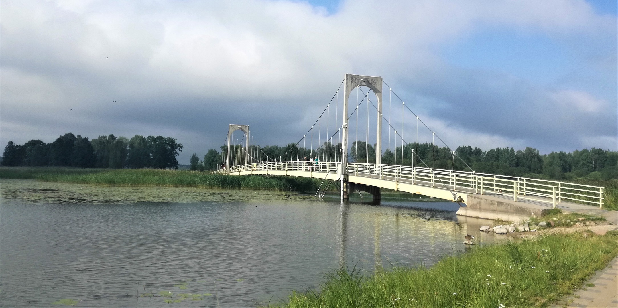
2. Võru city- lake Tamula and promenade
Võru is a charming small-town in South Estonia which is definitely worth visiting.
The window is located at the end of the beach promenade which runs along lake Tamula. Tamula beach is well maintained and you can take a swim there or relax in beach-bar. This frame also rotates so you can take pictures of the beach, lake Tamula or a pedestrian bridge to Roosisaare.
Location: https://goo.gl/maps/NVBbRehGUd72

3. Valga city
The city is cut into 2 halves by Estonian-Latvian border. But before the two countries were established Valga and Valka developed as one city. Since both countries are in the Schengen area we can say these cities are now back together. One city, two countries. A small window is located on side of the lake Pedeli.
Location: https://goo.gl/maps/zkc5a8bmcyw
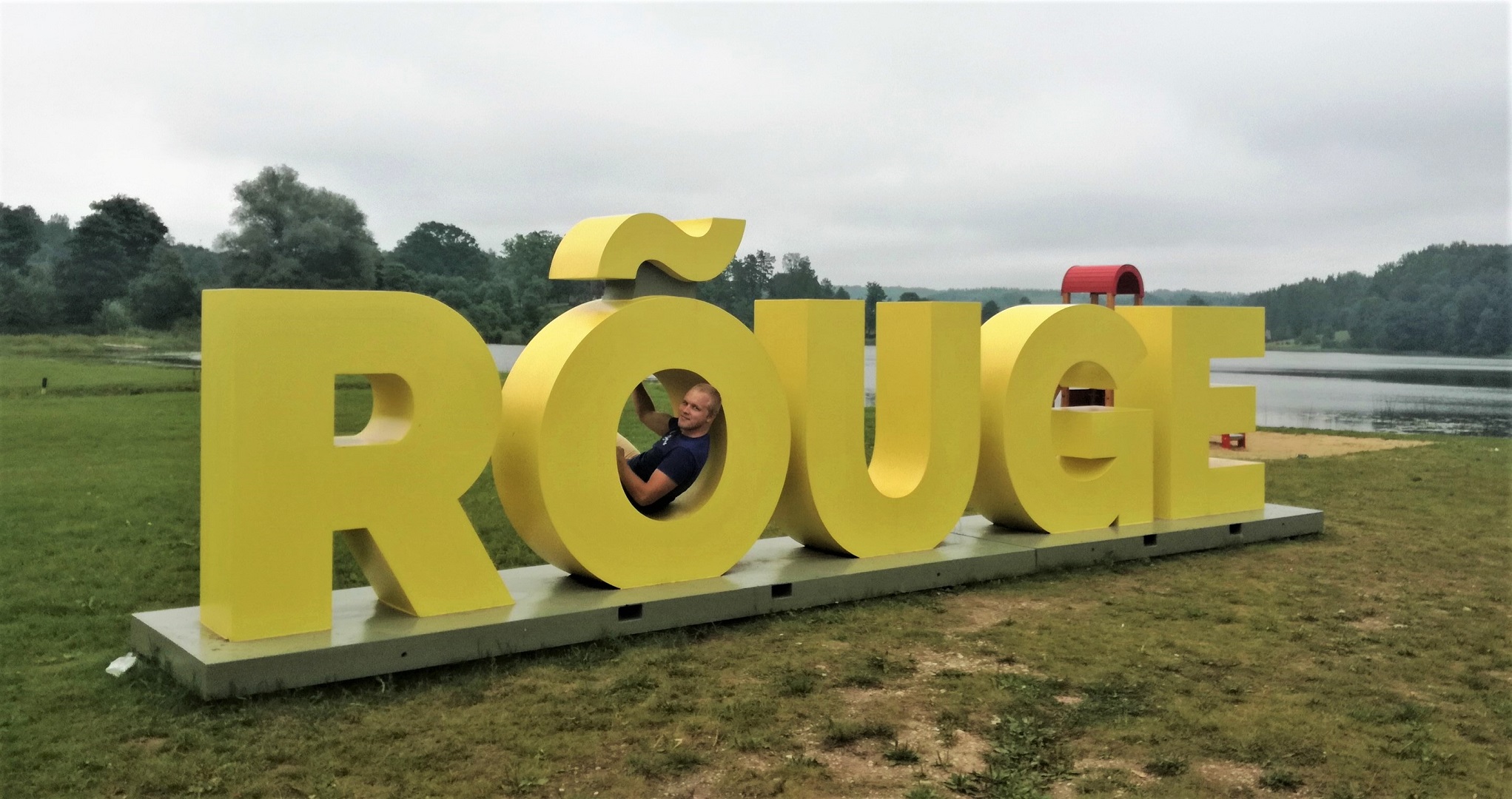
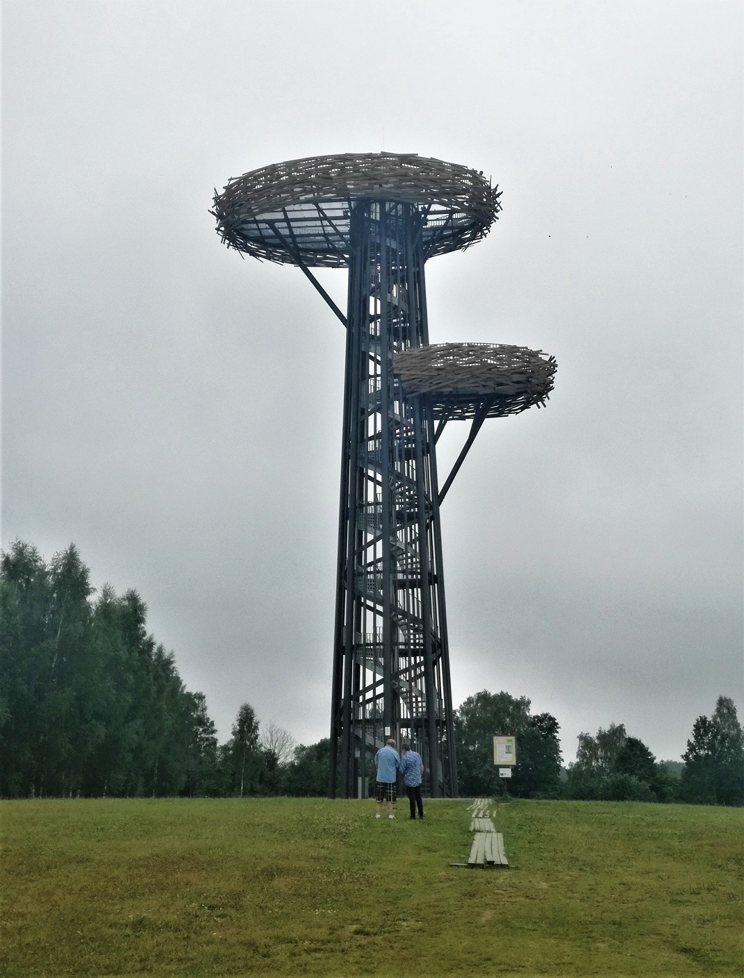
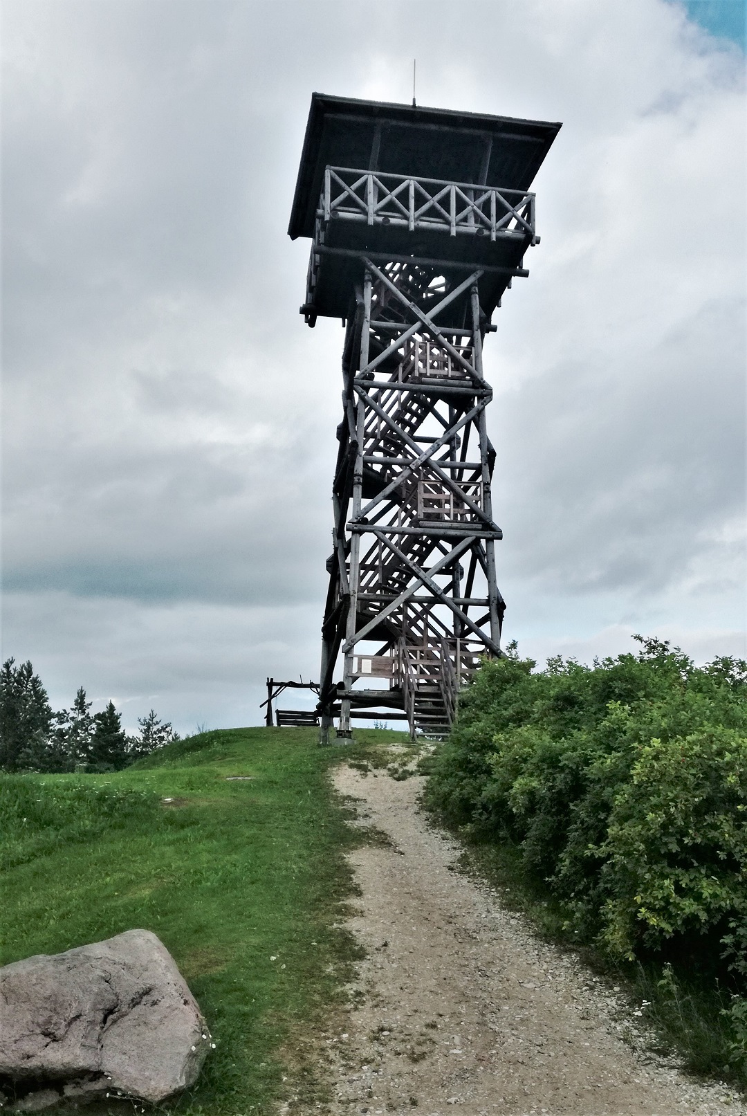
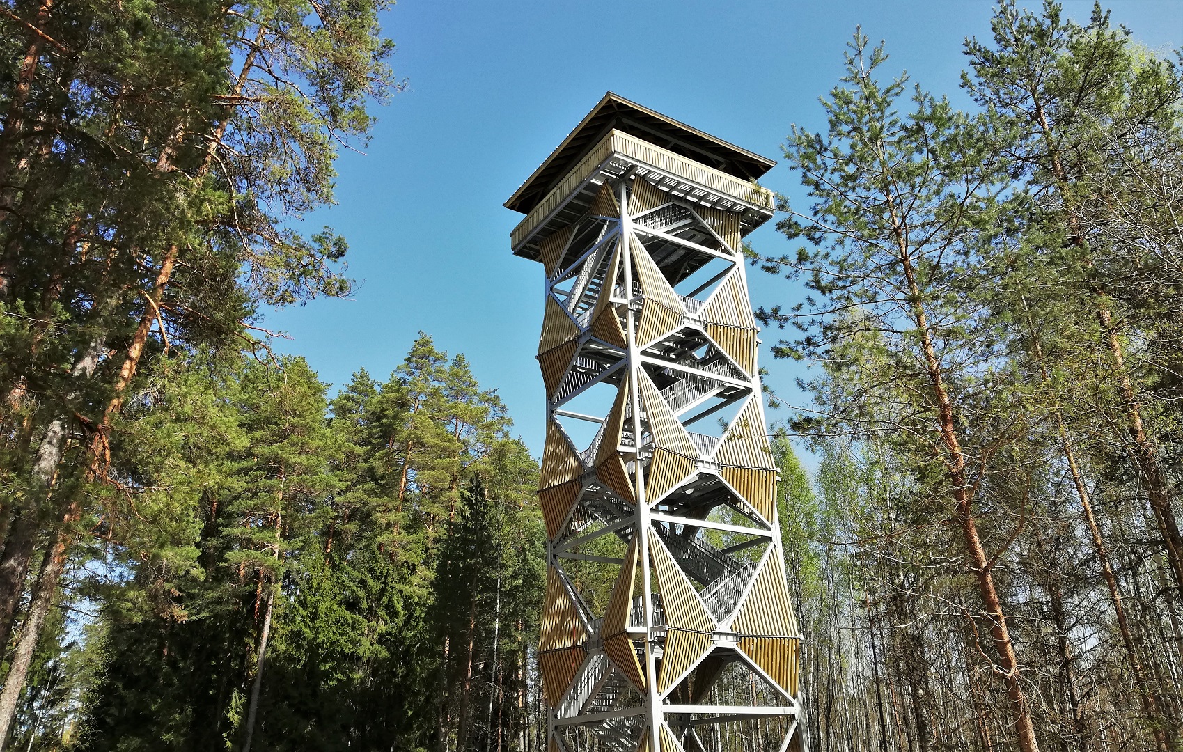
4. Rõuge primeval valley
Rõuge primeval valley is one of the most beautiful valleys in Estonia. The yellow window is located near lake Rõuge Suurjärv in the center of Rõuge small town. It’s the deepest lake in Estonia (38 meters).
There is a lot to see and visit nearby. Most noticeable is new Rõuge watchtower “
Location: https://goo.gl/maps/7p6cddnfLek
5. Suur Munamägi “mountain” and observation tower
This is the highest point of Estonia and Baltics with 317,4 meters. Height is measured from sea level. With relative height around 60 meters, it’s not much more than a hill on a world scale. You can visit the sightseeing tower (29.1 meters) on top of the hill.
The rotating yellow frame is located on the side of the small parking lot where stairs to the top of the hill start.
Location: https://goo.gl/maps/67ksW9WBc5T2
6. Räpina city – historical center
Yellow window in räpina marks the Sillapää Castle and Räpina paper factory. Sillapää Castle was built in the classical style in 1836 – 1842 and is one of the most remarkable late classicist buildings in Estonia. Paper factory holds one of Europe’s most unique examples of industrial architecture.
From Räpina Harbor (6.5 km away) you can also take a boat ride to Piirisaare island (as of 2019), where the hardest accessible Window is located.
Location: https://goo.gl/maps/Hk2rG8x1W1o
7. The beach of lake Peipus in Mustvee town
The lake Peipus is lying on the border of Estonia and Russia and is the biggest lake in Estonia and the fifth biggest lake in Europe. Lake Peipus is really popular in the summertime because there are the best beaches and smoked fish in Estonia! You can buy the smoked fish from small trucks on the streets of the small villages near the lake Peipus!
The yellow window is located right on the Mustvee beach, you can’t miss it.
Location: https://goo.gl/maps/tuqitudfSRAnGgSu5
8. Alatskivi Castle and the The Onion Route
Alatskivi Castle is a snow-white castle in the center of Alatskivi. The NG yellow window frame is located a little away from the castle, just go down from a small hill on the right side of the castle. Be aware- there are a lot of mosquitoes near the window.
The Onion Route is a chain of meandering villages on the shore of the Lake Peipus, inhabited both by Russians and Estonians living side by side. The area around Lake Peipus is famous by his onions (the soil is very good for growing the onions) and that’s why it is also called The Onion Route.
Location: https://goo.gl/maps/JA1JPSHzmn97N4wT8
9. Järvselja primeval forest reserve – study trail
This is a naturally beautiful and untouched study trail where you can observe the whole cycle of birth to death of trees in the primeval forest. We have not yet visited this place so not sure where exactly the NG yellow frame is located.
Presumed location: https://goo.gl/maps/ge6f6VqUX3LXrN5u7
10. Luunja river port
The NG window has placed to Luunja River Port because river Emajõgi has played a crucial role in people’s lives through the ages. From Luunja, you can travel from Luunja River Port along the River Emajõgi to Tartu or all the way to Lake Võrtsjärv. Luunja would be an interesting place to visit if you are also planning to take a boat ride but there is not overly much to do on the mainland.
Location: https://goo.gl/maps/pazFSMyH3NKQRpw6A
11. The area of Saadjärv – Lake Saadjärv
Lake Saadjärve is a quick ride away from Tartu. A great destination for quick getaway’s which offers year-round activities and small beaches.
Saadjärve is a special one to us. It was our second visited frame and marks the birthplace of the idea to visit all others too. Place where our South Estonia road trips and exploration started.
The most popular places to visit nearby are Elistevere Loomapark (Elistvere animal park) and Jääaja Keskus (Ice Age center). In Elistevere Loomapark you can see the animals, who live mostly in Estonian forests, in the most possible natural environment. In the Jääaja Keskus you can see life-sized prehistoric animals and experience how the world and Estonian nature has developed through the ages. Both of the places are especially great to visit with children. There is also a nice sightseeing tower called Lähte Vaatetorn on the road there (or back) which is worth a visit.
Location: https://goo.gl/maps/8vyzbkcmx2QZjcLx6
12. Urvaste church and lake Uhtjärv
The NG yellow frame is top of the hill. You can see the scenic road through the primeval valley that separates the parish in two and Urvaste church on the other side of the valley. It’s a very characteristic example of south Estonian road.
Location: https://goo.gl/maps/22c7xcyqFcK2
13. Kambja church
Kambja church was built in the 14th century, then burned down in several wars and restored over and over again (like many other churches in Estonia). In Kambja church, there were Estonian first choir and one of the first peasant schools in Estonia. The yellow window is located right next to the church.
Location: https://goo.gl/maps/P2ryuyR3pSp
14. Otepää church and Town Hill
Otepää is Estonian winter capital. There are lots of ski trails and you can practice lots of winter sports activities. But there are quite many visitors on the summertime also, the main buzz on the summertime will be around Lake Pühajärve.
The Otepää church has an important role in Estonian history. The blue, black and white flag of the Estonian Student Union, which later became the official flag of the Republic of Estonia, was consecrated in the rectory of the Otepää church.
To find the yellow window you have to drive from Otepää center to Valga/Tehvandi stadion (sports center) direction (along the Tatra-Otepää-Sangaste road). It is just outside the center, on your left hand.
Location: https://goo.gl/maps/i17bAkZtbUjH34a26
15. Tõravere – Tartu Observatory
Tartu Observatory is not located in Tartu, but in Tõravere instead (20km away). Therefore it is also known as the Tõravere observatory. After arriving at the main building- you can see a path on the left that leads to several telescope domes. Walking is made more interesting by info boards that educate about the earth, sun, galaxies and so on. Like small journey while walking towards the small yellow frame located on the grass.
Location: https://goo.gl/maps/vYJFC5pLbdB2
16. Barclay de Tolly mausoleum
This is the final resting place of Michael Andreas Barclay de Tolly. Most probably you have never heard about him but most likely you have heard about Napoleon. When the French invasion of Russia began in 1812, Barclay de Tolly was the commander of the 1st Army of the West, the largest Army to face Napoleon.
Location: https://goo.gl/maps/QYzHU3BUxx62
17. Lüllemäe village
We just stopped in Lüllemäe for a photo to cross it off from our list. But there are some hiking trails in Lüllemäe. You can also visit Karula National Park, which is home for two animal species rarely found in Estonia or elsewhere in Europe: the European otter and the pond bat.
Location: https://goo.gl/maps/zwmzU9Q5UiUpxxtX9
18. Sangaste Castle
Sangaste Castle was the home for the Count of Rye- Friedrich Georg Magnus von Berg. Sangaste may unofficially be called the capital of rye- 130 years ago he managed to develop a new winter rye breed called “Sangaste, it is the oldest known variety of rye still in production today. For Estonians the rye is really important- Estonians have used rye as bread grain for more than a thousand years.
National Geographic yellow window is right after the parking lot and before the Sangaste castle. A window is placed to really good location- you can get stunning pictures through the window with the castle in the background.
Location: https://goo.gl/maps/RFYxGzvgR9z
19. Obinitsa village
Obinitsa is an old Seto village. Seto’s are the old ethnic group of Estonians, who have their own dialect and own traditions. Seto leelo (polyphonic singing tradition) is part of the UNESCO list of intangible cultural heritage. The aim of the yellow frame in Obinitsa is to introduce the traditional Seto culture, as well as different cultures and highlighting the continuity of life in the village.
The National Geographic yellow frame is located right on the center of Obinitsa and is visible from the road.
If you are interested in Seto culture, you should visit Seto Folk, which is an annual live music and heritage festival. There you can listen to (modern) traditional music, eat real Seto food, drink homebrewed beer, buy the local handicrafts and enjoy Seto hospitality.
Location: https://goo.gl/maps/8vQgCQZyiEBCy69s9
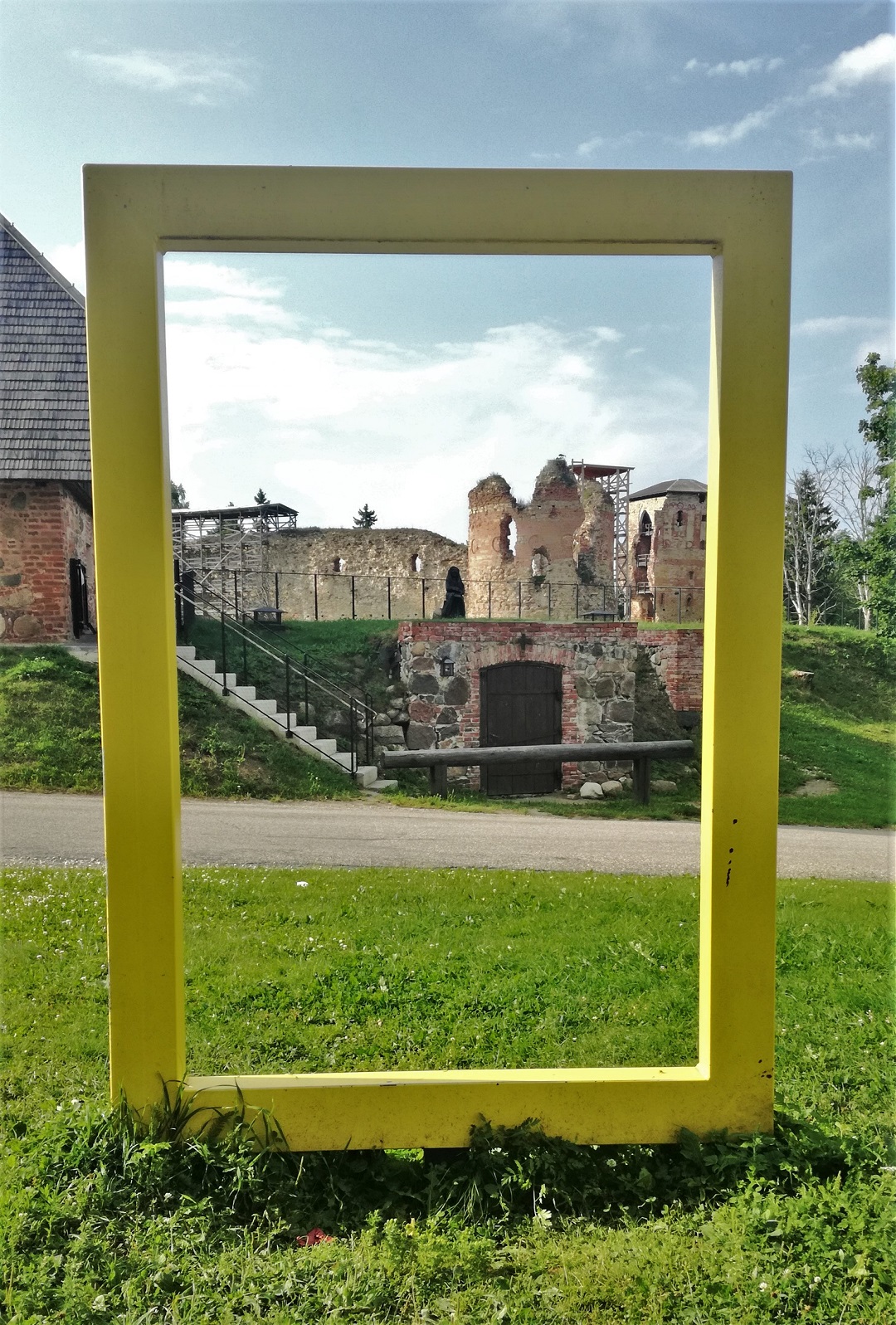
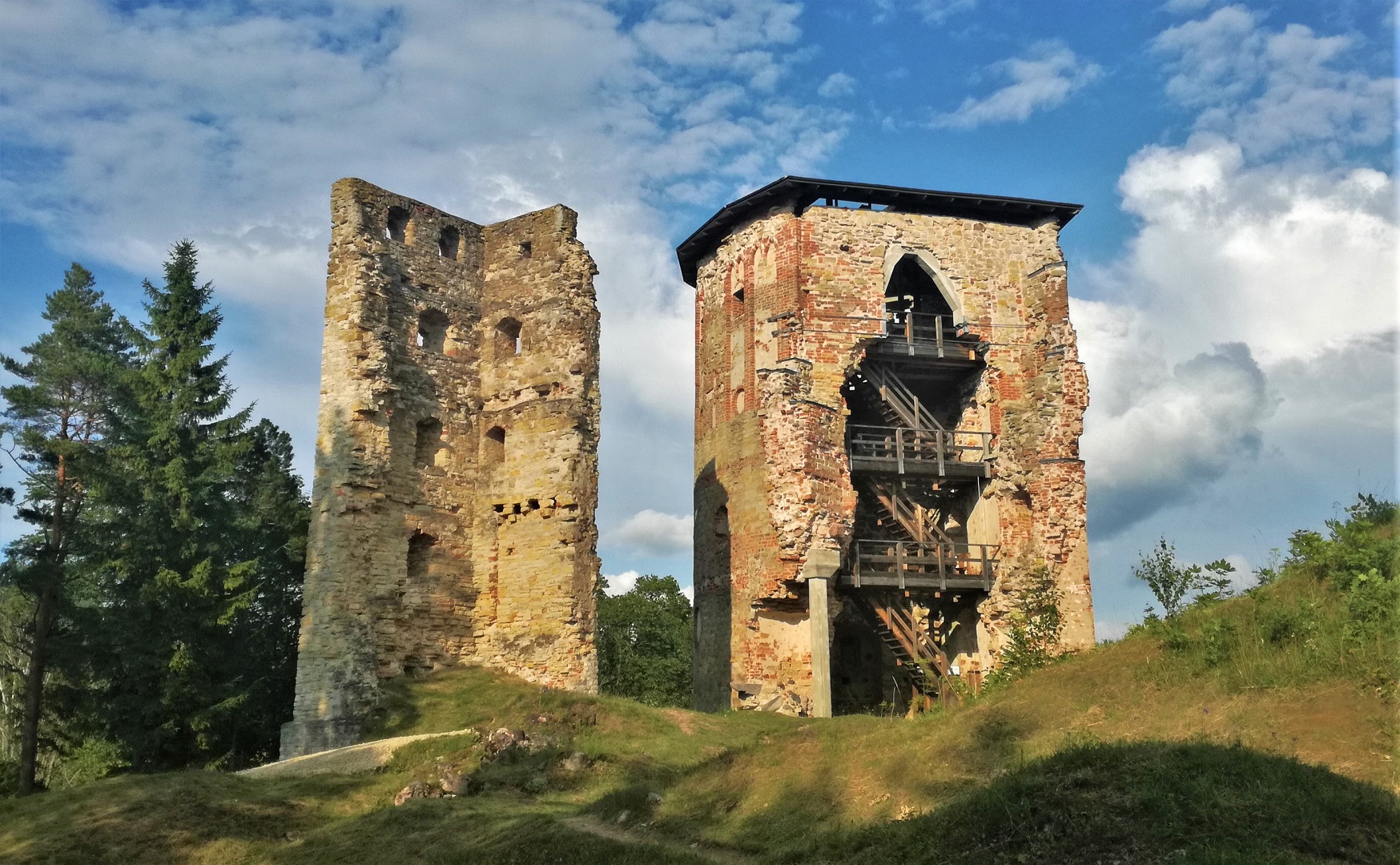
20. Ruins of the Vastseliina Castle
You can see ruins of the fortress from the 14th century. You can climb the tower, follow the nature trails and descend into the river valley. There are also a museum, excursions, programs, and workshops all related to pilgrims and medieval times. Read more info from their homepage.
Location: https://goo.gl/maps/J2RJZyTvTwE2
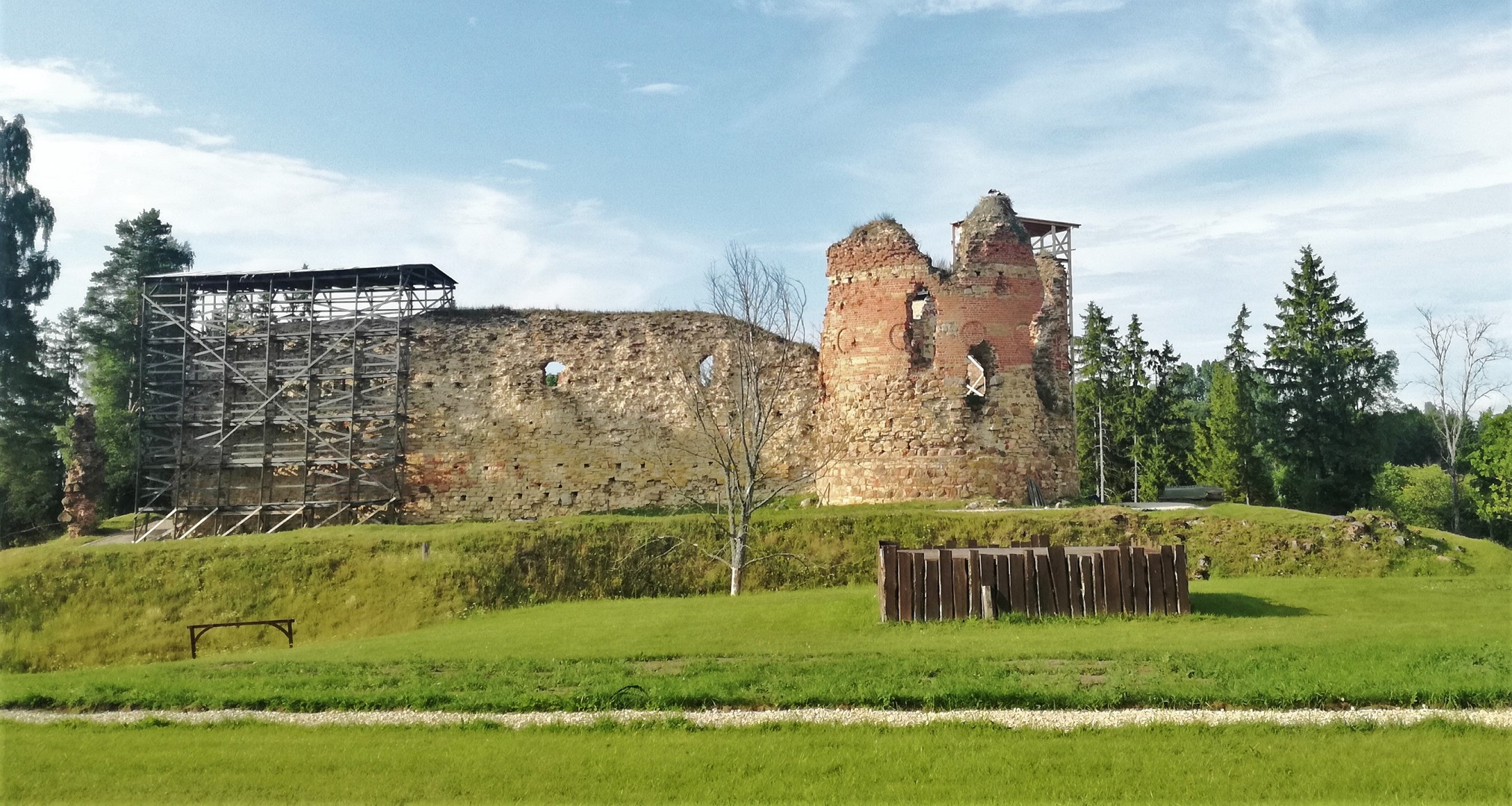
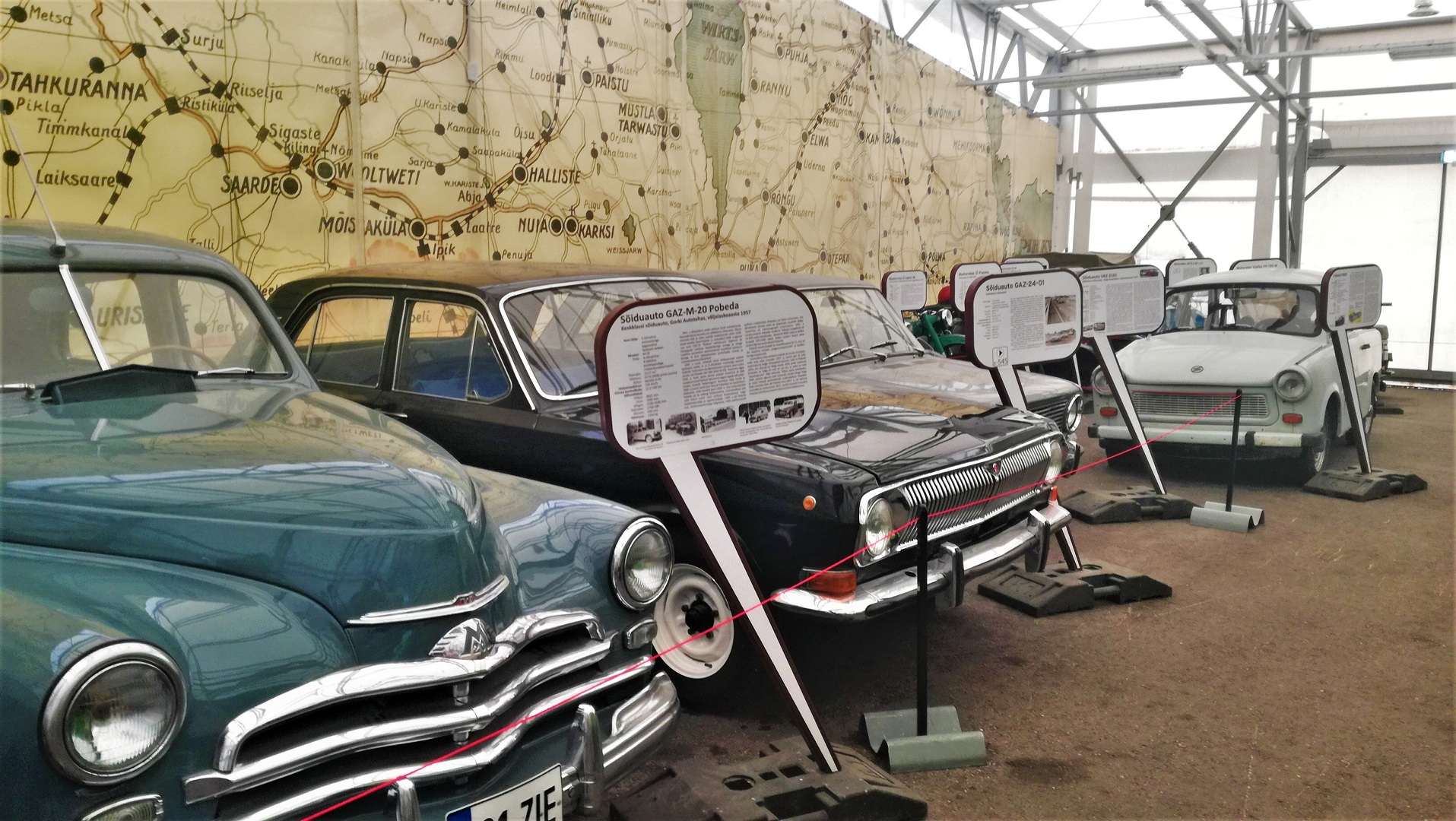
21. Estonian Road Museum
The museum is embedded into the somewhat hilly terrain on side of the winding roads of the old postal road from Tartu to Võru. It introduces the development of roads and traffic in Estonia. The main open-air exhibition leads you through the history of traffic, road construction and other related topics in one continuous path. It took us over 2 hours to explore the whole museum grounds. Definitely, a lot to explore especially if you are interested in old cars or heavy construction machinery. And even if you are not interested in those things, it is still quite an interesting place 🙂
Location: https://goo.gl/maps/RNDBRpeqNaB2
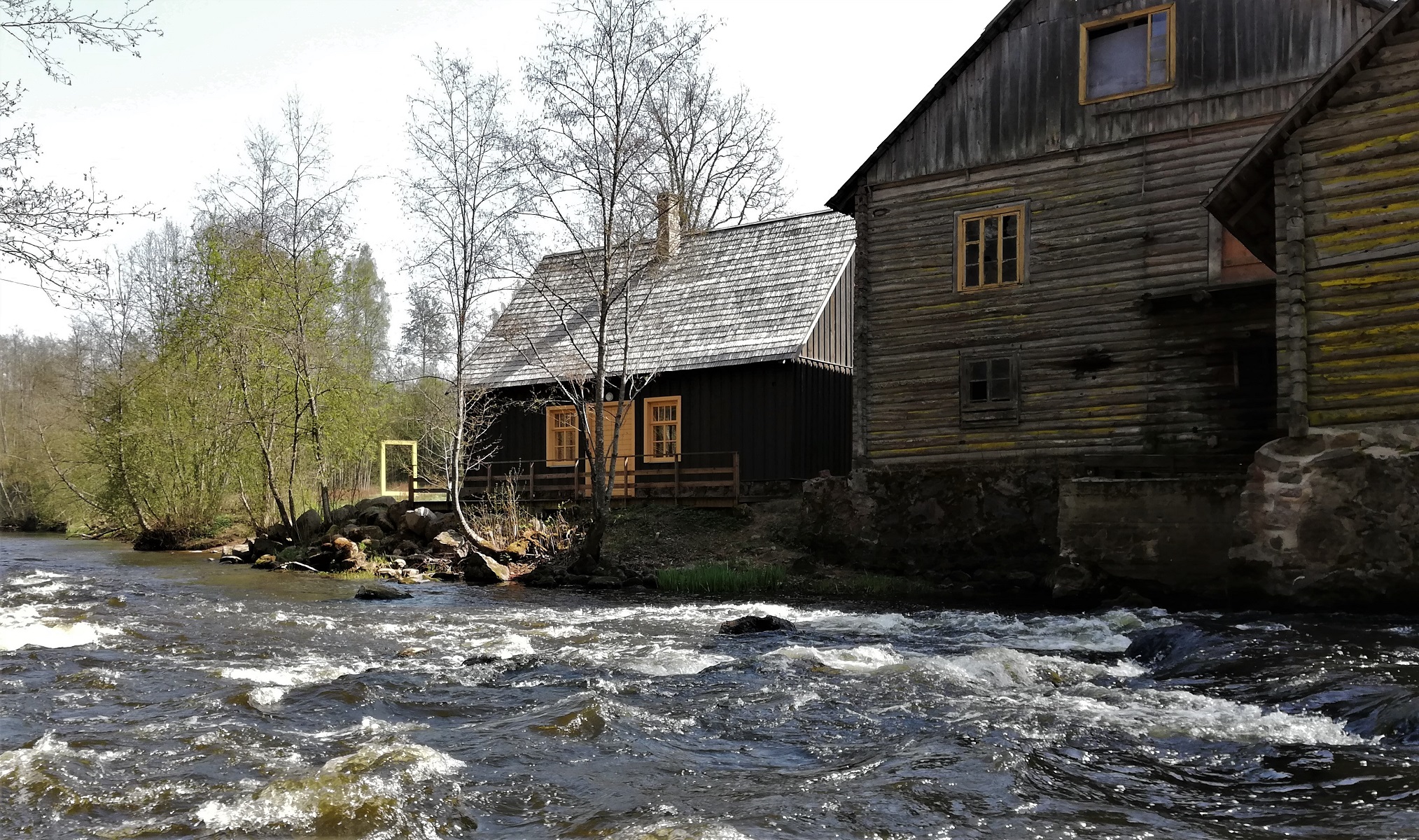
22. Süvahavva village
Süvahavva is a small village divided into two sides by Võhandu river. The yellow window is located in the center where the village chamber named “Külakoda” is located. It’s a place for meetings and celebrations for the residents of the neighboring villages and it is part of the old millhouse. There is also an old wool factory which is turned to a museum-factory where the process of wool to yarn can be learned. Its equipment is still workable and used.
Location: https://goo.gl/maps/d61TcDbK3VS7JnC26
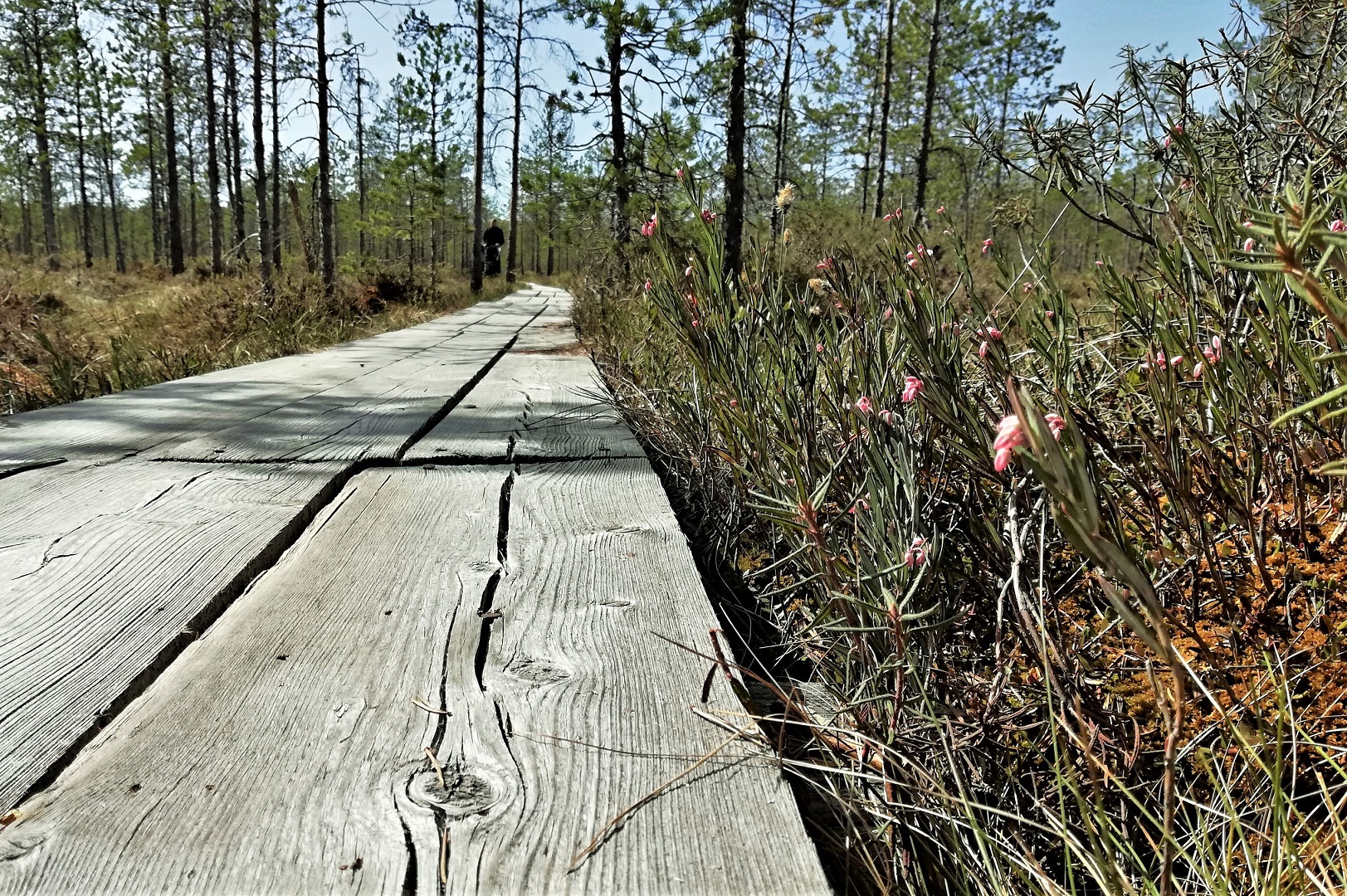
23. Valgesoo bog – study trail
To reach it you have to walk almost halfway through the wooden part of the study trail. This one is small and made out of wood instead of metal like others. Makes sense because metal one would be hard to get into the middle of the bog and does not need foundation.
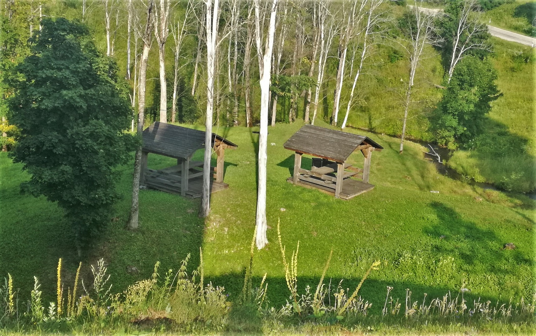
The nature path takes through different types of woods – circling back to the beginning. But be advised that the whole path is not a boardwalk. The second part of the path goes through rougher terrain so not suitable to baby strollers or wheelchairs. At the starting point of the trail, there is a watchtower with a height of 30 meters. Camp with fireplace and dry toilets are just behind it.
Location: https://goo.gl/maps/Ji8oANTDWJLgK3t27
24. The center of mainland Estonia
This one was hard to find since it was not correctly marked on the official map. We did a few rounds before we finally understand that place was on the other side of the small town Adavere. But to be honest- there is nothing much to do other than check it off the list while driving to other destinations.
Location: https://goo.gl/maps/Z4c1zuX9vQz
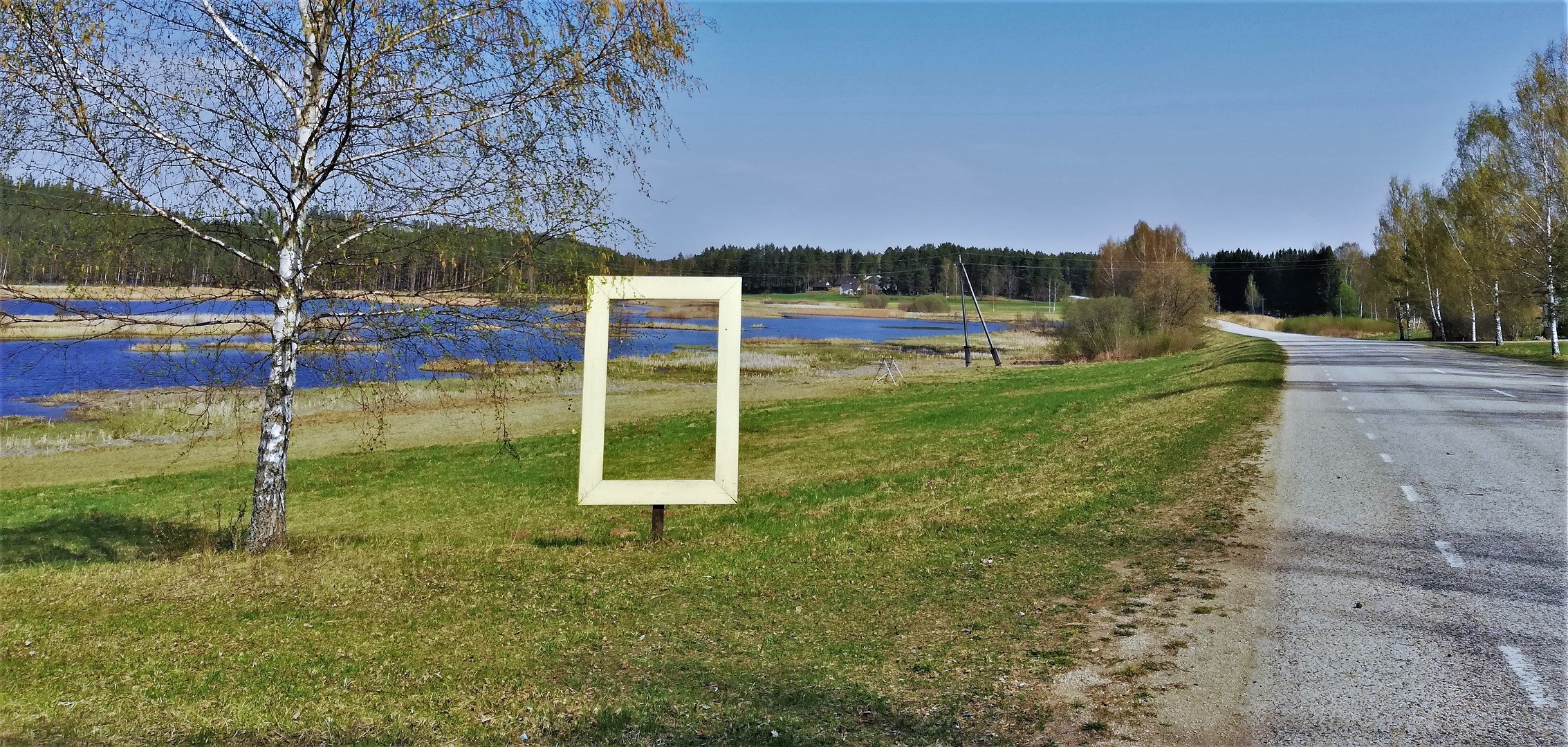
25. The area of lake Võrtsjärv
Võrtsjärv is the largest lake in Estonia that fully fits into Estonian borders. Janar has lived most of his life by the lake Võrtsjärv, but interestingly never visited that area before. Yellow window definitely serves it’s purpose there since, without it, we wouldn’t know or visit this place anytime soon either. There is a nice, wide and shallow beach behind the yellow window and grass ideal for a quick picnic. You also can climb the watching tower named “Jõesuu vaatetorn” which is located nearby.
Location: https://goo.gl/maps/J3USXijw6Wn
26. Kuremaa windmill
The windmill is a popular landmark in Kuremaa and it is part of the Kuremaa manor complex. Its massive stone building is ideal for catching a beautiful picture through the yellow window. It was refurbished in 2009 and can be rented as an event venue. It also features a small museum on the history of windmills in Estonia.
Location: https://goo.gl/maps/RaT8eBe1A3R2
27. Podmotsa village
This yellow window is one of the most rural. From the small harbor at the end of the road, you can see Russia and curch Kulje. But there is nothing much other to do than take a quick go on a village swing.
Location: https://goo.gl/maps/PUexvmy41Q62
28. Piirissaare Island
This might be difficult to visit as it’s located on an Island. But there is a regular boat line to visit Piirisaare from Räpina or Tartu. We don’t know where exactly this yellow window is located because we have not visited it ourselves yet. But if using boat line you have about 2-4 hours to search for it. It’s not a big island, so you should find it easily.
During summer your only option is by boat as far as we know. In winter time there might be some other ways like skiing hikes or ice road for cars.
Location: https://goo.gl/maps/5Q71jLumkY72
Lake Tabina – the unofficial one
Not sure about its origin, but probably local residents have been inspired by yellow windows project and created one by themselves on the shore of the lake Tabina. It’s a small wooden one.
Location: https://goo.gl/maps/kidQLD6JTrb6L2z88
Are there any other countries with “National Geographic” yellow photo frames?
We know that there must be National Geographic inspired yellow frames in the Netherlands since the Estonian project originated from there, but we were unable to find any information on them. Which is interesting. This project stands for promoting tourism and should be easily discoverable. We only succeeded to find some photos, but no website.
Same goes for the frames in the Cape Town area. There should be at least 7 of them in there. Bit different than in Estonia & Netherlands, but with the same idea. Check out this article and Instagram tag.
Also, there is a plan to introduce them in Northern Ireland. They prepare to install six frames in rural beauty spots across Derry and Strabane.
Other than these- we were not able to find any other. It seems these NG frames are hard to find and meant to be a hidden gem in those areas. Please let us know if there are more such places in the world.
Final words
Of course, there is a lot more to visit in South-Estonia and between these yellow frames, but it’s a good place to start your discoveries. These frames can lead your way if you are not sure what to see.
To get inspired, you can find out what others have done inside yellow frames trough following Instagram hashtags: #kollasedaknad #kollaneaken #nationalgeographicwindows and account @kollaneaken
0